
Thank you for supporting this site ❤️
Make a donation
Make a donation
West District topographic map
Click on the map to display elevation.
Thank you for supporting this site ❤️
Make a donation
Make a donation
About this map
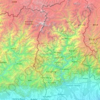
Name: West District topographic map, elevation, terrain.
Location: West District, West Sikkim District, Sikkim, 737111, India (26.63333 87.55000 28.03333 88.95000)
Average elevation: 2,636 m
Minimum elevation: 77 m
Maximum elevation: 8,489 m
Thank you for supporting this site ❤️
Make a donation
Make a donation
Other topographic maps
Click on a map to view its topography, its elevation and its terrain.