
Thank you for supporting this site ❤️
Make a donation
Make a donation
Stanton Lacy topographic map
Click on the map to display elevation.
Thank you for supporting this site ❤️
Make a donation
Make a donation
About this map
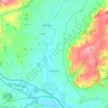
Name: Stanton Lacy topographic map, elevation, terrain.
Location: Stanton Lacy, Shropshire, England, United Kingdom (52.39297 -2.77971 52.43900 -2.66698)
Average elevation: 137 m
Minimum elevation: 83 m
Maximum elevation: 278 m
Thank you for supporting this site ❤️
Make a donation
Make a donation
Other topographic maps
Click on a map to view its topography, its elevation and its terrain.