
Thank you for supporting this site ❤️
Make a donation
Make a donation
Apache Point topographic map
Click on the map to display elevation.
Thank you for supporting this site ❤️
Make a donation
Make a donation
About this map
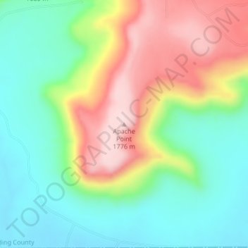
Name: Apache Point topographic map, elevation, terrain.
Location: Apache Point, Harding County, New Mexico, United States (35.79527 -104.17919 35.79537 -104.17909)
Average elevation: 1,597 m
Minimum elevation: 1,483 m
Maximum elevation: 1,776 m
Thank you for supporting this site ❤️
Make a donation
Make a donation
Other topographic maps
Click on a map to view its topography, its elevation and its terrain.