Vienna topographic map
Click on the map to display elevation.
Vienna
Vienna is located in northeastern Austria, at the easternmost extension of the Alps in the Vienna Basin. The earliest settlement, at the location of today's inner city, was south of the meandering Danube while the city now spans both sides of the river. Elevation ranges from 151 to 542 m (495 to 1,778 ft). The city has a total area of 414.65 square kilometers (160.1 sq mi), making it the largest city in Austria by area.
About this map
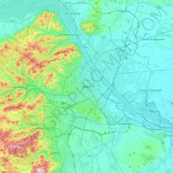
Name: Vienna topographic map, elevation, terrain.
Location: Vienna, 1010, Austria (48.04835 16.21250 48.36835 16.53250)
Average elevation: 231 m
Minimum elevation: 145 m
Maximum elevation: 650 m
Other topographic maps
Click on a map to view its topography, its elevation and its terrain.

Vienna
Vienna is located in northeastern Austria, at the easternmost extension of the Alps in the Vienna Basin. The earliest settlement, at the location of today's inner city, was south of the meandering Danube while the city now spans both sides of the river. Elevation ranges from 151 to 542 m (495 to 1,778 ft). The…
Average elevation: 227 m
Zell am See
Austria > Salzburg > Bezirk Zell am See
Zell am See provides winter skiing on the above Schmittenhöhe mountain. The skiable area is approximately 138 km, including the pistes on the Kitzsteinhorn and Kaprun Maiskogel. The ski pass covers the whole area including transport to and from the glacier which is open most of the year, dependent on…
Average elevation: 1,118 m


Vienna
Vienna is located in northeastern Austria, at the easternmost extension of the Alps in the Vienna Basin. The earliest settlement, at the location of today's inner city, was south of the meandering Danube while the city now spans both sides of the river. Elevation ranges from 151 to 542 m (495 to 1,778 ft). The…
Average elevation: 227 m


Breitenfurt bei Wien
Austria > Lower Austria > Bezirk Mödling
Breitenfurt lies in the Vienna woods directly abutting the city of Vienna on the southwest in the valley of the Liesing. The municipality is one of the largest in the area and has a population density of 197/km2. The municipality has large elevation changes and lies between 260 and 592 meters above sea level.
Average elevation: 401 m


Lingenau
Austria > Vorarlberg > Bezirk Bregenz
Lingenau is located southeast of Lake Constance, at an altitude of 685m. 30.8% of the area is wooded. There are no other cadastral communities in Lingenau. It is a member of the German-Austrian joint project Naturpark Nagelfluhkette.
Average elevation: 717 m


Grinzens
Austria > Tyrol > Bezirk Innsbruck-Land
Grinzens is a municipality in the Austrian state of Tyrol in the district of Innsbruck-Land. As of January 2015, its population is 1414. It lies southwest of the city of Innsbruck at an elevation of 945 m.
Average elevation: 1,692 m


Hallstatt
Austria > Upper Austria > Bezirk Gmunden
The Hallstatt salt mine is the world's oldest working salt mine. The mine is located within the Upper Permian to Lower Triassic Haselgebirge Formation of the Northern Limestone Alps. The Hallstatt salt mine comprises 21 levels and several smaller shafts ranging from 514 m above sea level (Erbstollen level) to…
Average elevation: 1,514 m


Ramsau am Dachstein
Austria > Styria > Bezirk Liezen
Ramsau am Dachstein is situated between the Dachstein range of mountains in the north and the Enns valley in the south. While the Dachstein range contains peaks up to 2,995 m (9,826 ft) and the towns of the Enns valley, such as Schladming, lie at around 700 m (2,300 ft) above sea level, the Ramsau plateau is a…
Average elevation: 1,526 m


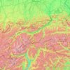


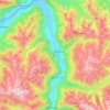
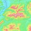
Wilder Kaiser
Austria > Tyrol > Bezirk Kufstein
The Kaiser Mountains are divided into the Wilder Kaiser or Wild Kaiser chain of mountains, formed predominantly of bare limestone rock, and the Zahmer Kaiser ("Tame Kaiser"), whose southern side is mainly covered by mountain pine. These two mountain ridges are linked by the 1,580-metre-high Stripsenjoch pass,…
Average elevation: 976 m


Graz
Graz is situated on both sides of the Mur river in southeast Austria. It is about 150 km (93 mi) southwest of Vienna (Wien). The nearest larger urban centre is Maribor (Marburg) in Slovenia, which is about 50 km (31 mi) to the south. Graz is the state capital and largest city in Styria, a green and heavily…
Average elevation: 426 m


Ellmau
Austria > Tyrol > Bezirk Kufstein
Ellmau is a municipality in the district of Kufstein in the Austrian region of Sölllandl. It lies 12 km southeast of Kufstein and 9 km west of Sankt Johann in Tirol. It is located at an elevation of 820 m above sea level. It was first mentioned in the records in 1155. Today it is part of the Ski Welt skiing…
Average elevation: 1,143 m

Bruck an der Großglocknerstraße
Austria > Salzburg > Bezirk Zell am See
The Grossglockner High Alpine Road, as a high-altitude mountain road, connects the two Austrian provinces of Salzburg and Carinthia. The span from Bruck to Heiligenblut along the road is 47.8 kilometres (29.7 mi) long. At Bruck-Fusch station the municipality has access to the Salzburg-Tyrol Railway line.
Average elevation: 1,155 m


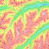


Damüls
Austria > Vorarlberg > Bezirk Bregenz
Damüls is situated at an altitude of 1,430 m. It has an area of 20.92 km². It borders on the Bregenz Forest, the Biosphere Reserve Großes Walsertal, the Laternsertal, and all other Vorarlberg districts (Bludenz, Feldkirch and Dornbirn). The most famous mountain peak in the area, a popular hiking destination…
Average elevation: 1,608 m

Hallstatt
Austria > Upper Austria > Bezirk Gmunden
The Hallstatt salt mine is the world's oldest working salt mine. The mine is located within the Upper Permian to Lower Triassic Haselgebirge Formation of the Northern Limestone Alps. The Hallstatt salt mine comprises 21 levels and several smaller shafts ranging from 514 metres (1,686 ft) above sea level…
Average elevation: 1,514 m


Nauders
Austria > Tyrol > Bezirk Landeck
The town lies in the valley of the Stillebach (a tributary of the Inn) in the Ötztal Alps, at an altitude of 1,394 m (4,573 ft). It is located about 29 km (18 mi) south of the district capital Landeck, on the road that leads from Pfunds in the Inntal valley via the narrow Finstermünz Gorge up to Reschen Pass…
Average elevation: 1,938 m


Grundlsee
Austria > Styria > Bezirk Liezen
The climate in Grundlsee is determined by its geographical location in the Aussee Basin. It is characterized mainly by the high altitude and the location in the northern congestion area. The result is, in the case of flow conditions from the west to the north, often days of precipitation, which in winter are…
Average elevation: 1,240 m


Gschnitz
Austria > Tyrol > Bezirk Innsbruck-Land
The Sanctuary of St. Magdalena is located near the border, between Gschnitz and Trins, at an altitude of 1,661 m (5,449 ft) accessible only on foot, under the Schönberg. The church is the oldest in the valley as confirmed by the Romanesque frescoes dating back around 1200 and discovered in 1959.
Average elevation: 2,017 m
Graz
Graz is situated on both sides of the river Mur in southeast Austria. It is about 150 km (93 mi) southwest of Vienna (Wien). The nearest larger urban centre is Maribor (Marburg) in Slovenia, which is about 50 km (31 mi) to the south. Graz is the capital of Styria and the largest city in the federal state, a…
Average elevation: 426 m


Burgenland
The province has a long history of Slavic, as well Austrian-German and Hungarian-Magyar settlement. The province's easternmost portion (the shores of the Neusiedler See) carried its own topographical term Seewinkel in Austrian-German. This is the area least influenced by Austrian-German since the Hungarian and…
Average elevation: 373 m

Kaprun
Austria > Salzburg > Bezirk Zell am See
Kaprun (German pronunciation: [kaˈpruːn]) is a municipality in the Zell am See District in the province of Salzburg in Austria. Together with the neighboring city of Zell am See the town presents itself as the tourist destination and skiing area "Zell am See-Kaprun". Kaprun distinguishes itself from its…
Average elevation: 1,819 m

Ramsau am Dachstein
Austria > Styria > Bezirk Liezen
Ramsau am Dachstein is situated between the Dachstein range of mountains in the north and the Enns valley in the south. While the Dachstein range contains peaks up to 2,995 m (9,826 ft) and the towns of the Enns valley, such as Schladming, lie at around 700 m (2,300 ft) above sea level, the Ramsau plateau is a…
Average elevation: 1,526 m


Katastralgemeinde Winzendorf
Austria > Lower Austria > Bezirk Wiener Neustadt > Winzendorf-Muthmannsdorf > Winzendorf
Average elevation: 368 m

Bad Gastein
Bad Gastein has a humid continental climate (Dfb) bordering on a subarctic climate (Dfc) due to the town's high elevation. Summers are mild, sometimes warm with cool, refreshing nights. Winters are moderately cold and snowy, with annual snowfall averaging 345 cm (136 inches).
Average elevation: 1,929 m
Vienna
Vienna is located in northeastern Austria, at the easternmost extension of the Alps in the Vienna Basin. The earliest settlement, at the location of today's inner city, was south of the meandering Danube, while the city now spans both sides of the river. Elevation ranges from 151 to 542 m (495 to 1,778 ft).…
Average elevation: 227 m


Gmunden
Austria > Upper Austria > Bezirk Gmunden
Gmunden covers an area of 63.49 square kilometres (24.51 sq mi) and has a median elevation of 425 metres (1,394 ft). It is situated next to the lake Traunsee on the Traun River and is surrounded by high mountains, including the Traunstein (5,446 feet; 1,660 m), the Erlakogel (5,150 feet; 1,570 m), the Wilder…
Average elevation: 692 m
Hallstatt
Austria > Upper Austria > Bezirk Gmunden
The Hallstatt salt mine is the world's oldest working salt mine. The mine is located within the Upper Permian to Lower Triassic Haselgebirge Formation of the Northern Limestone Alps. The Hallstatt salt mine comprises 21 levels and several smaller shafts ranging from 514 metres (1,686 ft) above sea level…
Average elevation: 1,514 m


Vorarlberg
The highest mountain is the Piz Buin, whose rocky peak of 3,312 m (10,866 ft) is surrounded by glaciers. The distance from Lake Constance and the plains of the Alpine Rhine valley across the medium altitude and high Alpine zones to the glaciers of the Silvretta range is a mere 90 km (56 mi).
Average elevation: 1,382 m