
Thank you for supporting this site ❤️
Make a donation
Make a donation
Kalady topographic map
Click on the map to display elevation.
Thank you for supporting this site ❤️
Make a donation
Make a donation
About this map
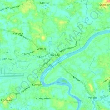
Name: Kalady topographic map, elevation, terrain.
Location: Kalady, Aluva, Ernakulam district, Kerala, 683550, India (10.12663 76.39905 10.20663 76.47905)
Average elevation: 14 m
Minimum elevation: 0 m
Maximum elevation: 53 m
Thank you for supporting this site ❤️
Make a donation
Make a donation
Other topographic maps
Click on a map to view its topography, its elevation and its terrain.