
Thank you for supporting this site ❤️
Make a donation
Make a donation
Greenup topographic map
Click on the map to display elevation.
Thank you for supporting this site ❤️
Make a donation
Make a donation
About this map
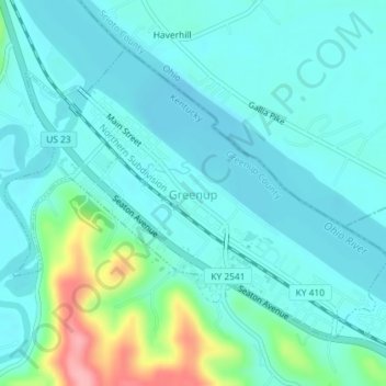
Name: Greenup topographic map, elevation, terrain.
Location: Greenup, Greenup County, Kentucky, United States (38.56262 -82.84786 38.58382 -82.81181)
Average elevation: 176 m
Minimum elevation: 153 m
Maximum elevation: 275 m
Thank you for supporting this site ❤️
Make a donation
Make a donation
Other topographic maps
Click on a map to view its topography, its elevation and its terrain.