
Make a donation
Scofield Reservoir topographic map
Click on the map to display elevation.
Make a donation
Scofield Reservoir
Scofield Reservoir is a 2,815-acre (11.39 km2) reservoir impounded by Scofield Dam, in Carbon County, Utah. Located on the Price River, a tributary of the Green River, Scofield Reservoir is adjacent to northernmost boundary of the Manti–La Sal National Forest. The reservoir sits at an elevation of 7,618 feet (2,322 m), on the northern edge of the Wasatch Plateau. Utah State Route 96 runs along the western shoreline.
Make a donation
About this map
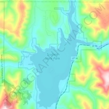
Name: Scofield Reservoir topographic map, elevation, terrain.
Location: Scofield Reservoir, Carbon County, Utah, United States (39.74814 -111.17269 39.81400 -111.11997)
Average elevation: 2,435 m
Minimum elevation: 2,307 m
Maximum elevation: 2,804 m
Make a donation
Other topographic maps
Click on a map to view its topography, its elevation and its terrain.