
Thank you for supporting this site ❤️
Make a donation
Make a donation
Kalavad topographic map
Click on the map to display elevation.
Thank you for supporting this site ❤️
Make a donation
Make a donation
Kalavad
Kalavad is located at 22°13′N 70°23′E / 22.22°N 70.38°E / 22.22; 70.38. It has an average elevation of 87 metres (285 feet).
Thank you for supporting this site ❤️
Make a donation
Make a donation
About this map
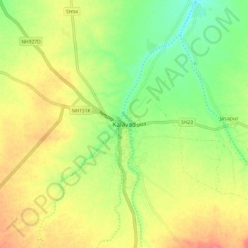
Name: Kalavad topographic map, elevation, terrain.
Average elevation: 100 m
Minimum elevation: 71 m
Maximum elevation: 128 m
Thank you for supporting this site ❤️
Make a donation
Make a donation