
Arzberg topographic map
Interactive map
Click on the map to display elevation.
About this map
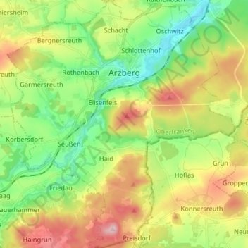
Name: Arzberg topographic map, elevation, terrain.
Average elevation: 540 m
Minimum elevation: 447 m
Maximum elevation: 683 m
Other topographic maps
Click on a map to view its topography, its elevation and its terrain.
Heidelheim
Duitsland > Beieren > Landkreis Wunsiedel im Fichtelgebirge > Selb > Heidelheim
Heidelheim, Selb, Landkreis Wunsiedel im Fichtelgebirge, Beieren, Duitsland
Average elevation: 574 m