
Thank you for supporting this site ❤️
Make a donation
Make a donation
Carisbrooke topographic map
Click on the map to display elevation.
Thank you for supporting this site ❤️
Make a donation
Make a donation
About this map
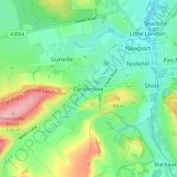
Name: Carisbrooke topographic map, elevation, terrain.
Location: Carisbrooke, Isle of Wight, England, PO30 1NS, United Kingdom (50.67115 -1.33288 50.71115 -1.29288)
Average elevation: 42 m
Minimum elevation: -9 m
Maximum elevation: 134 m
Thank you for supporting this site ❤️
Make a donation
Make a donation
Other topographic maps
Click on a map to view its topography, its elevation and its terrain.