
Thank you for supporting this site ❤️
Make a donation
Make a donation
Arnsdorf topographic map
Click on the map to display elevation.
Thank you for supporting this site ❤️
Make a donation
Make a donation
About this map
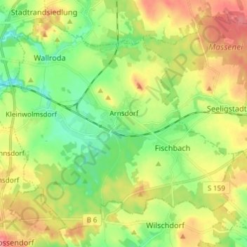
Name: Arnsdorf topographic map, elevation, terrain.
Location: Arnsdorf, Bautzen - Budyšin, Saxony, 01477, Germany (51.06086 13.92593 51.12663 14.04729)
Average elevation: 272 m
Minimum elevation: 236 m
Maximum elevation: 320 m
Thank you for supporting this site ❤️
Make a donation
Make a donation
Other topographic maps
Click on a map to view its topography, its elevation and its terrain.
Thank you for supporting this site ❤️
Make a donation
Make a donation
Thank you for supporting this site ❤️
Make a donation
Make a donation