
Thank you for supporting this site ❤️
Make a donation
Make a donation
Syracuse topographic map
Click on the map to display elevation.
Thank you for supporting this site ❤️
Make a donation
Make a donation
About this map
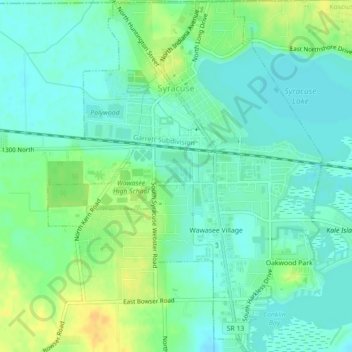
Name: Syracuse topographic map, elevation, terrain.
Location: Syracuse, Kosciusko County, Indiana, United States (41.40303 -85.76861 41.43607 -85.73412)
Average elevation: 267 m
Minimum elevation: 257 m
Maximum elevation: 283 m
Thank you for supporting this site ❤️
Make a donation
Make a donation
Other topographic maps
Click on a map to view its topography, its elevation and its terrain.