
Thank you for supporting this site ❤️
Make a donation
Make a donation
Converse topographic map
Click on the map to display elevation.
Thank you for supporting this site ❤️
Make a donation
Make a donation
About this map
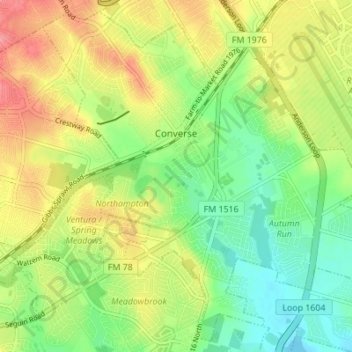
Name: Converse topographic map, elevation, terrain.
Location: Converse, Bexar County, Texas, 78109, United States (29.48266 -98.34220 29.53863 -98.27366)
Average elevation: 223 m
Minimum elevation: 187 m
Maximum elevation: 267 m
Thank you for supporting this site ❤️
Make a donation
Make a donation
Other topographic maps
Click on a map to view its topography, its elevation and its terrain.