
Thank you for supporting this site ❤️
Make a donation
Make a donation
Gragg topographic map
Click on the map to display elevation.
Thank you for supporting this site ❤️
Make a donation
Make a donation
About this map
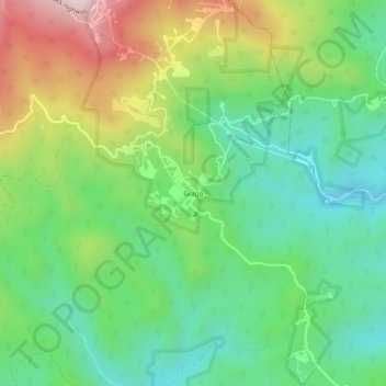
Name: Gragg topographic map, elevation, terrain.
Location: Gragg, Avery County, North Carolina, United States (36.05318 -81.79066 36.09318 -81.75066)
Average elevation: 825 m
Minimum elevation: 597 m
Maximum elevation: 1,242 m
Thank you for supporting this site ❤️
Make a donation
Make a donation
Other topographic maps
Click on a map to view its topography, its elevation and its terrain.