
Thank you for supporting this site ❤️
Make a donation
Make a donation
Old Harbour topographic map
Click on the map to display elevation.
Thank you for supporting this site ❤️
Make a donation
Make a donation
About this map
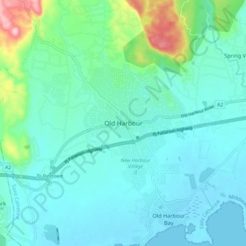
Name: Old Harbour topographic map, elevation, terrain.
Location: Old Harbour, Saint Catherine, Middlesex County, Jamaica (17.89839 -77.15342 17.97839 -77.07342)
Average elevation: 42 m
Minimum elevation: -1 m
Maximum elevation: 239 m
Thank you for supporting this site ❤️
Make a donation
Make a donation
Other topographic maps
Click on a map to view its topography, its elevation and its terrain.