
Alt-Hoeselt topographic map
Interactive map
Click on the map to display elevation.
About this map
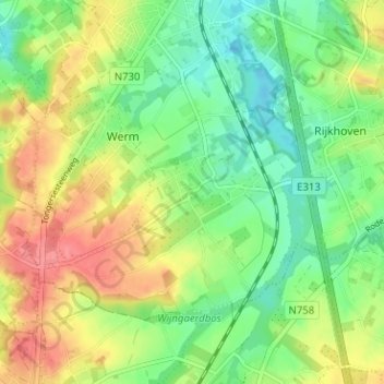
Name: Alt-Hoeselt topographic map, elevation, terrain.
Location: Alt-Hoeselt, Hoeselt, Tongeren, Limburg, 3730, België (50.80776 5.47195 50.84776 5.51195)
Average elevation: 85 m
Minimum elevation: 55 m
Maximum elevation: 124 m
Het plateau, met een hoogte tot 100 meter, wordt benut voor landbouw en fruitteelt.
Other topographic maps
Click on a map to view its topography, its elevation and its terrain.
Sint-Huibrechts-Hern
België > Limburg > Tongeren > Hoeselt
Sint-Huibrechts-Hern, Hoeselt, Tongeren, Limburg, Vlaanderen, België
Average elevation: 91 m