
Thank you for supporting this site ❤️
Make a donation
Make a donation
Goose Prairie topographic map
Click on the map to display elevation.
Thank you for supporting this site ❤️
Make a donation
Make a donation
About this map
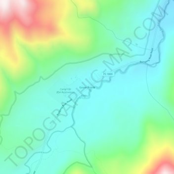
Name: Goose Prairie topographic map, elevation, terrain.
Location: Goose Prairie, Yakima County, Washington, United States (46.87522 -121.28701 46.91522 -121.24701)
Average elevation: 1,156 m
Minimum elevation: 943 m
Maximum elevation: 1,746 m
Thank you for supporting this site ❤️
Make a donation
Make a donation
Other topographic maps
Click on a map to view its topography, its elevation and its terrain.