
Thank you for supporting this site ❤️
Make a donation
Make a donation
Lake Cushman topographic map
Click on the map to display elevation.
Thank you for supporting this site ❤️
Make a donation
Make a donation
About this map
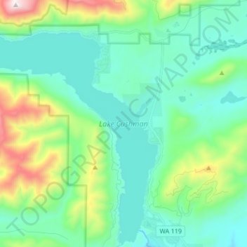
Name: Lake Cushman topographic map, elevation, terrain.
Location: Lake Cushman, Mason County, Washington, United States (47.41655 -123.32318 47.50808 -123.21158)
Average elevation: 410 m
Minimum elevation: 153 m
Maximum elevation: 1,281 m
Thank you for supporting this site ❤️
Make a donation
Make a donation