
Thank you for supporting this site ❤️
Make a donation
Make a donation
Tolar topographic map
Click on the map to display elevation.
Thank you for supporting this site ❤️
Make a donation
Make a donation
About this map
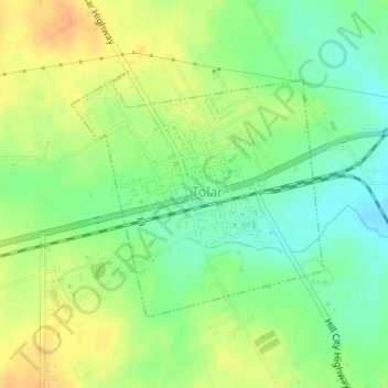
Name: Tolar topographic map, elevation, terrain.
Location: Tolar, Hood County, Texas, United States (32.38065 -97.93071 32.39778 -97.90988)
Average elevation: 317 m
Minimum elevation: 299 m
Maximum elevation: 334 m
Thank you for supporting this site ❤️
Make a donation
Make a donation