
Thank you for supporting this site ❤️
Make a donation
Make a donation
Raceland topographic map
Click on the map to display elevation.
Thank you for supporting this site ❤️
Make a donation
Make a donation
About this map
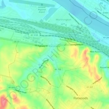
Name: Raceland topographic map, elevation, terrain.
Location: Raceland, Greenup County, Kentucky, United States (38.52443 -82.76063 38.54978 -82.71398)
Average elevation: 185 m
Minimum elevation: 156 m
Maximum elevation: 242 m
Thank you for supporting this site ❤️
Make a donation
Make a donation
Other topographic maps
Click on a map to view its topography, its elevation and its terrain.