
Gharoh topographic map
Click on the map to display elevation.
About this map
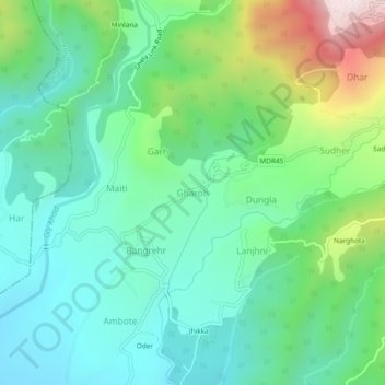
Name: Gharoh topographic map, elevation, terrain.
Location: Gharoh, Dharamshala, Kangra, Himachal Pradesh, 176217, India (32.19101 76.26449 32.23101 76.30449)
Average elevation: 1,029 m
Minimum elevation: 807 m
Maximum elevation: 1,619 m
Other topographic maps
Click on a map to view its topography, its elevation and its terrain.