
Thank you for supporting this site ❤️
Make a donation
Make a donation
Whitefish Township topographic map
Click on the map to display elevation.
Thank you for supporting this site ❤️
Make a donation
Make a donation
About this map
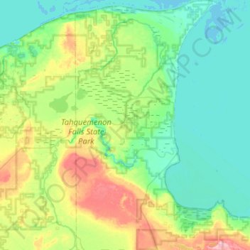
Name: Whitefish Township topographic map, elevation, terrain.
Location: Whitefish Township, Chippewa County, Michigan, United States (46.41847 -85.24155 46.77287 -84.94813)
Average elevation: 212 m
Minimum elevation: 176 m
Maximum elevation: 330 m
Thank you for supporting this site ❤️
Make a donation
Make a donation
Other topographic maps
Click on a map to view its topography, its elevation and its terrain.
Thank you for supporting this site ❤️
Make a donation
Make a donation
Thank you for supporting this site ❤️
Make a donation
Make a donation
Thank you for supporting this site ❤️
Make a donation
Make a donation
Thank you for supporting this site ❤️
Make a donation
Make a donation
Thank you for supporting this site ❤️
Make a donation
Make a donation