
Thank you for supporting this site ❤️
Make a donation
Make a donation
Belmont topographic map
Click on the map to display elevation.
Thank you for supporting this site ❤️
Make a donation
Make a donation
About this map
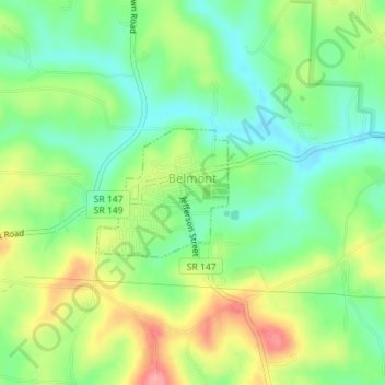
Name: Belmont topographic map, elevation, terrain.
Location: Belmont, Belmont County, Ohio, United States (40.02370 -81.04777 40.03273 -81.03572)
Average elevation: 361 m
Minimum elevation: 321 m
Maximum elevation: 422 m
Thank you for supporting this site ❤️
Make a donation
Make a donation
Other topographic maps
Click on a map to view its topography, its elevation and its terrain.
Thank you for supporting this site ❤️
Make a donation
Make a donation
Thank you for supporting this site ❤️
Make a donation
Make a donation
Thank you for supporting this site ❤️
Make a donation
Make a donation
Thank you for supporting this site ❤️
Make a donation
Make a donation