
Thank you for supporting this site ❤️
Make a donation
Make a donation
Georges Lake topographic map
Click on the map to display elevation.
Thank you for supporting this site ❤️
Make a donation
Make a donation
About this map
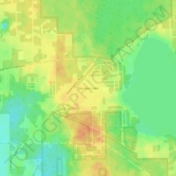
Name: Georges Lake topographic map, elevation, terrain.
Location: Georges Lake, Putnam County, Florida, 32140, United States (29.77385 -81.88815 29.81385 -81.84815)
Average elevation: 39 m
Minimum elevation: 17 m
Maximum elevation: 58 m
Thank you for supporting this site ❤️
Make a donation
Make a donation
Other topographic maps
Click on a map to view its topography, its elevation and its terrain.