
Thank you for supporting this site ❤️
Make a donation
Make a donation
South Farmingdale topographic map
Click on the map to display elevation.
Thank you for supporting this site ❤️
Make a donation
Make a donation
South Farmingdale
South Farmingdale is located on a flat outwash plain, and as such, the hamlet's topography is largely flat. Additionally, South Farmingdale is split between the Massapequa Creek and Seaford Creek drainage areas, and is located within the larger Long Island Sound/Atlantic Ocean Watershed.
Thank you for supporting this site ❤️
Make a donation
Make a donation
About this map
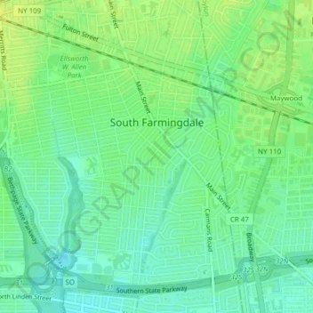
Name: South Farmingdale topographic map, elevation, terrain.
Average elevation: 19 m
Minimum elevation: 10 m
Maximum elevation: 27 m
Thank you for supporting this site ❤️
Make a donation
Make a donation
Other topographic maps
Click on a map to view its topography, its elevation and its terrain.
Valley Stream
United States > New York > Nassau County > Valley Stream > Valley Stream
Average elevation: 9 m
Thank you for supporting this site ❤️
Make a donation
Make a donation