
Thank you for supporting this site ❤️
Make a donation
Make a donation
Walnut Creek topographic map
Click on the map to display elevation.
Thank you for supporting this site ❤️
Make a donation
Make a donation
About this map
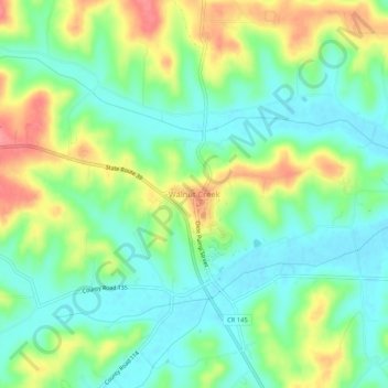
Name: Walnut Creek topographic map, elevation, terrain.
Location: Walnut Creek, Holmes County, Ohio, 44687, United States (40.52145 -81.74180 40.56145 -81.70180)
Average elevation: 327 m
Minimum elevation: 298 m
Maximum elevation: 377 m
Thank you for supporting this site ❤️
Make a donation
Make a donation
Other topographic maps
Click on a map to view its topography, its elevation and its terrain.