
Lac de la Raviège topographic map
Interactive map
Click on the map to display elevation.
About this map
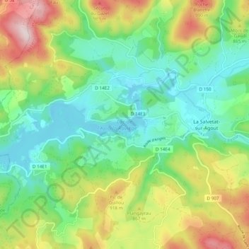
Name: Lac de la Raviège topographic map, elevation, terrain.
Average elevation: 798 m
Minimum elevation: 655 m
Maximum elevation: 1,073 m
Other topographic maps
Click on a map to view its topography, its elevation and its terrain.
Condax
France > Occitanie > Hérault > La Salvetat-sur-Agout
Condax, La Salvetat-sur-Agout, Béziers, Hérault, Occitanie, France métropolitaine, 34330, France
Average elevation: 756 m
Lixirié
France > Occitanie > Hérault > La Salvetat-sur-Agout
Lixirié, La Salvetat-sur-Agout, Béziers, Hérault, Occitanie, France métropolitaine, 34330, France
Average elevation: 754 m
Les Barthèzes
France > Occitanie > Hérault > La Salvetat-sur-Agout > Les Barthèzes
Les Barthèzes, La Salvetat-sur-Agout, Béziers, Hérault, Occitanie, France métropolitaine, 34330, France
Average elevation: 933 m