
Thank you for supporting this site ❤️
Make a donation
Make a donation
Elk Rapids topographic map
Click on the map to display elevation.
Thank you for supporting this site ❤️
Make a donation
Make a donation
About this map
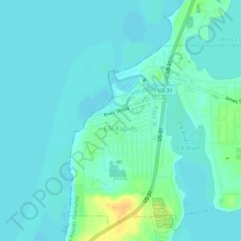
Name: Elk Rapids topographic map, elevation, terrain.
Location: Elk Rapids, Antrim County, Michigan, 49629, United States (44.88411 -85.42466 44.90873 -85.38792)
Average elevation: 180 m
Minimum elevation: 173 m
Maximum elevation: 201 m
Thank you for supporting this site ❤️
Make a donation
Make a donation
Other topographic maps
Click on a map to view its topography, its elevation and its terrain.