
Thank you for supporting this site ❤️
Make a donation
Make a donation
El Empalme topographic map
Click on the map to display elevation.
Thank you for supporting this site ❤️
Make a donation
Make a donation
About this map
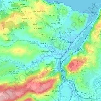
Name: El Empalme topographic map, elevation, terrain.
Location: El Empalme, Carreño, Asturias, 33492, España (43.53381 -5.75364 43.57381 -5.71364)
Average elevation: 60 m
Minimum elevation: -1 m
Maximum elevation: 183 m
Thank you for supporting this site ❤️
Make a donation
Make a donation
Other topographic maps
Click on a map to view its topography, its elevation and its terrain.