
Thank you for supporting this site ❤️
Make a donation
Make a donation
Bethlehem Gate topographic map
Click on the map to display elevation.
Thank you for supporting this site ❤️
Make a donation
Make a donation
About this map
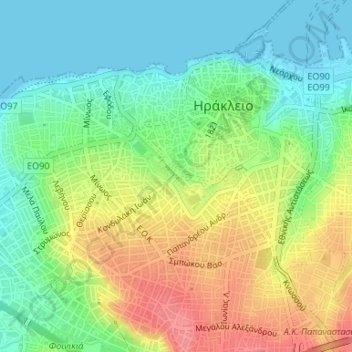
Name: Bethlehem Gate topographic map, elevation, terrain.
Average elevation: 32 m
Minimum elevation: -1 m
Maximum elevation: 80 m
Thank you for supporting this site ❤️
Make a donation
Make a donation
Other topographic maps
Click on a map to view its topography, its elevation and its terrain.
Knossos Palace
Greece > Region of Crete > Heraklion Regional Unit > Heraklion Municipal Unit
The identification of Knossos with the Bronze Age site is supported by the Roman coins that were scattered over the fields surrounding the pre-excavation site, then a large mound named Kephala Hill, elevation 85 m (279 ft) from current sea level. Many of them were inscribed with Knosion or Knos on the obverse…
Average elevation: 151 m
2nd Community of Heraklion - Eastern
Greece > Region of Crete > Heraklion Regional Unit > Heraklion Municipal Unit
Average elevation: 29 m