
Belton topographic map
Interactive map
Click on the map to display elevation.
About this map
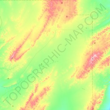
Name: Belton topographic map, elevation, terrain.
Average elevation: 512 m
Minimum elevation: 348 m
Maximum elevation: 794 m
Other topographic maps
Click on a map to view its topography, its elevation and its terrain.
Carrieton
Australia > South Australia > The District Council of Orroroo Carrieton
Carrieton, The District Council of Orroroo Carrieton, South Australia, 5432, Australia
Average elevation: 481 m
Orroroo
Australia > South Australia > The District Council of Orroroo Carrieton > Orroroo
Orroroo, The District Council of Orroroo Carrieton, South Australia, 5431, Australia
Average elevation: 447 m