
右江区 topographic map
Interactive map
Click on the map to display elevation.
About this map
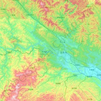
Name: 右江区 topographic map, elevation, terrain.
Location: 右江区, 百色市, 广西壮族自治区, 中国 (23.54207 106.11619 24.29481 106.93531)
Average elevation: 532 m
Minimum elevation: 99 m
Maximum elevation: 1,573 m
Other topographic maps
Click on a map to view its topography, its elevation and its terrain.