
Thermes topographic map
Interactive map
Click on the map to display elevation.
About this map
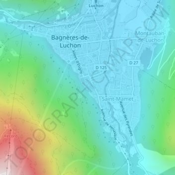
Name: Thermes topographic map, elevation, terrain.
Average elevation: 855 m
Minimum elevation: 616 m
Maximum elevation: 1,759 m
Other topographic maps
Click on a map to view its topography, its elevation and its terrain.
Ravi
France > Occitanie > Haute-Garonne > Bagnères-de-Luchon
Ravi, Bagnères-de-Luchon, Saint-Gaudens, Haute-Garonne, Occitanie, France métropolitaine, 31110, France
Average elevation: 1,254 m