
Thank you for supporting this site ❤️
Make a donation
Make a donation
Taplejung topographic map
Click on the map to display elevation.
Thank you for supporting this site ❤️
Make a donation
Make a donation
Taplejung
Geographically Taplejung is a mountainous district where the world's third highest peak Kanchenjunga (8586 m) is located. It is situated at elevation ranging from 670 metres (2,200 ft) to 8,586 metres (28,169 ft) from sea level.
Thank you for supporting this site ❤️
Make a donation
Make a donation
About this map
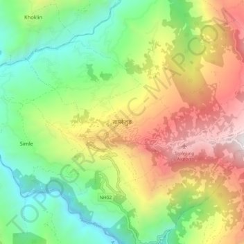
Name: Taplejung topographic map, elevation, terrain.
Location: Taplejung, Phungling, Taplejung, Koshi Province, 57500, Nepal (27.31870 87.63273 27.39870 87.71273)
Average elevation: 1,410 m
Minimum elevation: 556 m
Maximum elevation: 2,666 m
Thank you for supporting this site ❤️
Make a donation
Make a donation
Other topographic maps
Click on a map to view its topography, its elevation and its terrain.