
Thank you for supporting this site ❤️
Make a donation
Make a donation
Ciaro topographic map
Click on the map to display elevation.
Thank you for supporting this site ❤️
Make a donation
Make a donation
About this map
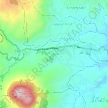
Name: Ciaro topographic map, elevation, terrain.
Location: Ciaro, Bandung, West Java, Java, Indonesia (-7.06239 107.89328 -7.02239 107.93328)
Average elevation: 785 m
Minimum elevation: 613 m
Maximum elevation: 1,227 m
Thank you for supporting this site ❤️
Make a donation
Make a donation