
Make a donation
Olenyok River topographic map
Click on the map to display elevation.
Make a donation
About this map
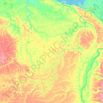
Name: Olenyok River topographic map, elevation, terrain.
Location: Olenyok River, Far Eastern Federal District, 678480, Russia (67.08956 108.27763 73.18785 123.83179)
Average elevation: 182 m
Minimum elevation: -4 m
Maximum elevation: 1,301 m
Make a donation
Other topographic maps
Click on a map to view its topography, its elevation and its terrain.
Прасковеевка
Russia > Krasnodar Krai > городской округ Геленджик > Praskoveyevka
Average elevation: 166 m
Mount Elbrus (East Summit)
Russia > Kabardino-Balkaria > Elbrus District
As Elbrus is located in the Northern Hemisphere, the summer period, the least rigorous, takes place from June to mid-September with an average of 50% of sunny days favorable to the ascent of the summit. However, the winds, dominated by westerly air masses, can turn violent and temperatures drop very quickly.…
Average elevation: 5,160 m