
Thank you for supporting this site ❤️
Make a donation
Make a donation
Laburan Baru topographic map
Click on the map to display elevation.
Thank you for supporting this site ❤️
Make a donation
Make a donation
About this map
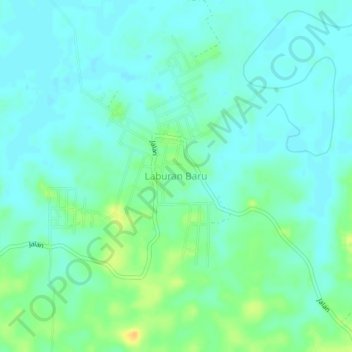
Name: Laburan Baru topographic map, elevation, terrain.
Location: Laburan Baru, Paser, East Kalimantan, Kalimantan, Indonesia (-1.99030 116.29040 -1.95030 116.33040)
Average elevation: 8 m
Minimum elevation: 0 m
Maximum elevation: 28 m
Thank you for supporting this site ❤️
Make a donation
Make a donation
Other topographic maps
Click on a map to view its topography, its elevation and its terrain.