
Thank you for supporting this site ❤️
Make a donation
Make a donation
Amelia topographic map
Click on the map to display elevation.
Thank you for supporting this site ❤️
Make a donation
Make a donation
About this map
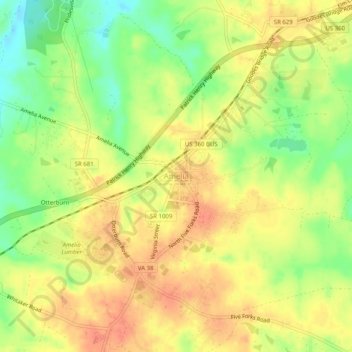
Name: Amelia topographic map, elevation, terrain.
Location: Amelia, Amelia County, Virginia, 23002, United States (37.32201 -78.00099 37.36201 -77.96099)
Average elevation: 107 m
Minimum elevation: 77 m
Maximum elevation: 128 m
Thank you for supporting this site ❤️
Make a donation
Make a donation
Other topographic maps
Click on a map to view its topography, its elevation and its terrain.