

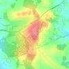
Stone topographic map
Click on the map to display elevation.
Stone
More recent research points to older, though no less interesting nor tangible, possibilities regarding its name and founding. Around Stone lie several Romano British sites and it is not inconceivable that the stone remains of a bridge or milestone, perhaps continuing the Roman road from Rocester to Blyth Bridge and then potentially through Stone, is alluded to in the name. The settlement of Walton (which now forms a suburb) is ancient Brythonic (Celtic/ancient Briton place name). The most likely derivation for most places called Stone is from a prehistoric megalith, Roman milestone, a natural boulder or rock formation, or from 'a place where stone was obtained' and a Keuper sandstone outcrop on the north side of Stone, long quarried for building materials, may be the topographical feature from which the place was named. It may also be noted that a huge stone or erratic is recorded on Common Plot and in that respect it is unclear whether Stone Field here, one of the open-fields of Stone is 'the field at Stone' or 'the field with the stone'.
About this map

Name: Stone topographic map, elevation, terrain.
Location: Stone, Stafford, Staffordshire, England, United Kingdom (52.87945 -2.16587 52.91551 -2.11471)
Average elevation: 107 m
Minimum elevation: 80 m
Maximum elevation: 164 m
Other topographic maps
Click on a map to view its topography, its elevation and its terrain.

Newcastle-under-Lyme
United Kingdom > England > Staffordshire > Newcastle-under-Lyme
Average elevation: 147 m


Marchington Woodlands
United Kingdom > England > Staffordshire > East Staffordshire
Average elevation: 120 m

College Gardens
United Kingdom > England > Staffordshire > Newcastle-under-Lyme > Madeley
Average elevation: 123 m


Tutbury Castle
United Kingdom > England > Staffordshire > East Staffordshire > Tutbury
Average elevation: 66 m

Burton upon Trent
United Kingdom > England > Staffordshire > East Staffordshire
Burton is about 109 miles (175 km) north west of London, about 30 miles north east of Birmingham, the UK's second largest city and about 23 miles east of the county town Stafford. It is at the easternmost border of the county of Staffordshire with Derbyshire, its suburbs and the course of the River Trent…
Average elevation: 69 m

Werrington
United Kingdom > England > Staffordshire > Staffordshire Moorlands
Average elevation: 229 m

Stubwood
United Kingdom > England > Staffordshire > East Staffordshire > Denstone
Average elevation: 113 m

Birch Cross
United Kingdom > England > Staffordshire > East Staffordshire > Marchington
Average elevation: 92 m



Biddulph Moor
United Kingdom > England > Staffordshire > Staffordshire Moorlands
Average elevation: 242 m


Wain Lea
United Kingdom > England > Staffordshire > Newcastle-under-Lyme > Harriseahead
Average elevation: 207 m

Weston Park
United Kingdom > England > Staffordshire > South Staffordshire > Weston under Lizard
Average elevation: 113 m



Stepping Stones
United Kingdom > England > Staffordshire > Staffordshire Moorlands
Average elevation: 224 m


Bottomhouse
United Kingdom > England > Staffordshire > Staffordshire Moorlands > Ipstones
Average elevation: 312 m


Apedale
United Kingdom > England > Staffordshire > Newcastle-under-Lyme > Chesterton
Average elevation: 168 m

Levedale
United Kingdom > England > Staffordshire > South Staffordshire > Penkridge
Average elevation: 98 m

Roughcote
United Kingdom > England > Staffordshire > Staffordshire Moorlands > Caverswall
Average elevation: 217 m


Blackshaw Moor
United Kingdom > England > Staffordshire > Staffordshire Moorlands > Thorncliffe
Average elevation: 282 m

Castle Ring
United Kingdom > England > Staffordshire > Cannock Chase > Cannock Wood
It is the highest point on The Chase with an elevation of 242 metres (794 ft).
Average elevation: 191 m


Hatherton Junction
United Kingdom > England > Staffordshire > South Staffordshire
Average elevation: 112 m


Knightley
United Kingdom > England > Staffordshire > Stafford > Gnosall > Knightley
Average elevation: 127 m

Alton Castle
United Kingdom > England > Staffordshire > Staffordshire Moorlands > Alton
Average elevation: 154 m

Himley
United Kingdom > England > Staffordshire > South Staffordshire > Himley
Average elevation: 96 m

Dunkirk
United Kingdom > England > Staffordshire > Newcastle-under-Lyme > Talke > Dunkirk
Average elevation: 149 m

Cannock Lake
United Kingdom > England > Staffordshire > South Staffordshire > Huntington
Average elevation: 149 m


Bullock's End
United Kingdom > England > Staffordshire > Lichfield > Drayton Basset > Bullock's End
Average elevation: 72 m

Totmonslow
United Kingdom > England > Staffordshire > Staffordshire Moorlands > Huntley
Average elevation: 170 m


Bignall End
United Kingdom > England > Staffordshire > Newcastle-under-Lyme > Audley
Average elevation: 150 m


Endon Bank
United Kingdom > England > Staffordshire > Staffordshire Moorlands > Endon
Average elevation: 192 m

Bednall
United Kingdom > England > Staffordshire > South Staffordshire > Bednall
Average elevation: 118 m

Gentleshaw Common
United Kingdom > England > Staffordshire > Lichfield > Longdon
Average elevation: 181 m


Halfpenny Green
United Kingdom > England > Staffordshire > South Staffordshire
Average elevation: 91 m

Blithfield Reservoir
United Kingdom > England > Staffordshire > East Staffordshire > Admaston
Average elevation: 108 m

Muckley Corner
United Kingdom > England > Staffordshire > Lichfield > Hammerwich
Average elevation: 120 m




Lower Lee
United Kingdom > England > Staffordshire > Staffordshire Moorlands > Meerbrook > Lower Lee
Average elevation: 264 m


Burntwood Green
United Kingdom > England > Staffordshire > Lichfield > Burntwood > Woodhouses
Average elevation: 137 m


Betley Mere
United Kingdom > England > Staffordshire > Borough of Newcastle-under-Lyme > Wrinehill > Cracow Moss
Average elevation: 81 m




Northwood
United Kingdom > England > Staffordshire > Newcastle-under-Lyme > Newcastle-under-Lyme
Average elevation: 131 m

Drointon
United Kingdom > England > Staffordshire > Stafford > Stowe-by-Chartley
Average elevation: 110 m

Harlow Wood
United Kingdom > England > Staffordshire > East Staffordshire > Upper Mayfield
Average elevation: 177 m

Horton
United Kingdom > England > Staffordshire > Staffordshire Moorlands > Gratton
Average elevation: 199 m


Merryton Low
United Kingdom > England > Staffordshire > Staffordshire Moorlands
Average elevation: 412 m

Wood Lane
United Kingdom > England > Staffordshire > Newcastle-under-Lyme > Bignall Hill
Average elevation: 168 m


Rushton Spencer
United Kingdom > England > Staffordshire > Staffordshire Moorlands
Average elevation: 204 m

Calf Heath
United Kingdom > England > Staffordshire > South Staffordshire > Hatherton Junction
Average elevation: 113 m

Chasewater
United Kingdom > England > Staffordshire > Lichfield > Burntwood > Chasetown
Average elevation: 155 m


Wetley Rocks
United Kingdom > England > Staffordshire > Staffordshire Moorlands
Average elevation: 229 m

Old Hannah's Hole
United Kingdom > England > Staffordshire > Staffordshire Moorlands > Wetton
Average elevation: 276 m

