
Make a donation
Perez topographic map
Click on the map to display elevation.
Make a donation
About this map
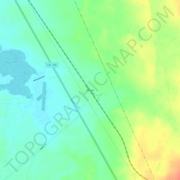
Name: Perez topographic map, elevation, terrain.
Location: Perez, Modoc County, California, United States (41.65627 -121.27415 41.69627 -121.23415)
Average elevation: 1,277 m
Minimum elevation: 1,260 m
Maximum elevation: 1,307 m
Make a donation
Other topographic maps
Click on a map to view its topography, its elevation and its terrain.
Alturas
United States > California > Modoc County
Alturas (Spanish for "Heights"; Achumawi: Kasalektawi) is a city and the county seat of Modoc County, California. Located in the Shasta Cascade region of Northern California, the city had a population of 2,715 at the 2020 census. Alturas is located at the confluence of the south and north forks of the Pit…
Average elevation: 1,336 m
Alturas
United States > California > Modoc County
Alturas (Spanish for "Heights"; Achumawi: Kasalektawi) is the only incorporated city in Modoc County, California of which it is also the county seat. Located in the Shasta Cascade region of Northern California, the city had a population of 2,715 at the 2020 census. Alturas is located at the confluence of the…
Average elevation: 1,337 m
Alturas
United States > California > Modoc County
Alturas (Spanish for "Heights"; Achumawi: Kasalektawi) is a city and the county seat of Modoc County, California. Located in the Shasta Cascade region of Northern California, the city had a population of 2,715 at the 2020 census. Alturas is located at the confluence of the south and north forks of the Pit…
Average elevation: 1,337 m
Make a donation