
Thank you for supporting this site ❤️
Make a donation
Make a donation
Ardirejo topographic map
Click on the map to display elevation.
Thank you for supporting this site ❤️
Make a donation
Make a donation
About this map
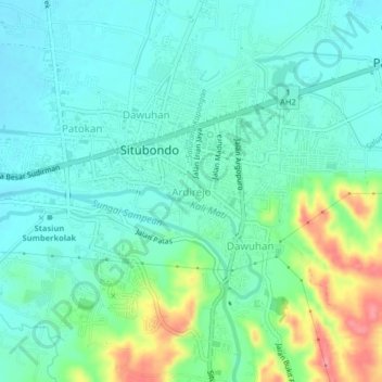
Name: Ardirejo topographic map, elevation, terrain.
Location: Ardirejo, Situbondo, East Java, Java, 68311, Indonesia (-7.73109 113.98984 -7.69109 114.02984)
Average elevation: 44 m
Minimum elevation: 20 m
Maximum elevation: 112 m
Thank you for supporting this site ❤️
Make a donation
Make a donation