
Thank you for supporting this site ❤️
Make a donation
Make a donation
Mutima Murungi topographic map
Click on the map to display elevation.
Thank you for supporting this site ❤️
Make a donation
Make a donation
About this map
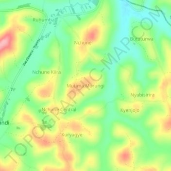
Name: Mutima Murungi topographic map, elevation, terrain.
Location: Mutima Murungi, Mbarara, Western Region, Uganda (-0.33454 30.58332 -0.29454 30.62332)
Average elevation: 1,414 m
Minimum elevation: 1,361 m
Maximum elevation: 1,485 m
Thank you for supporting this site ❤️
Make a donation
Make a donation
Other topographic maps
Click on a map to view its topography, its elevation and its terrain.