
Thank you for supporting this site ❤️
Make a donation
Make a donation
Aquinnah topographic map
Click on the map to display elevation.
Thank you for supporting this site ❤️
Make a donation
Make a donation
About this map
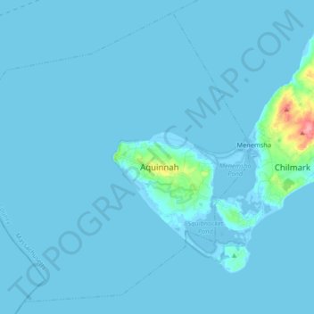
Name: Aquinnah topographic map, elevation, terrain.
Location: Aquinnah, Dukes County, Massachusetts, United States (41.29002 -70.92954 41.40379 -70.76553)
Average elevation: 3 m
Minimum elevation: -11 m
Maximum elevation: 85 m
Thank you for supporting this site ❤️
Make a donation
Make a donation
Other topographic maps
Click on a map to view its topography, its elevation and its terrain.
Thank you for supporting this site ❤️
Make a donation
Make a donation
Thank you for supporting this site ❤️
Make a donation
Make a donation