
Thank you for supporting this site ❤️
Make a donation
Make a donation
Kesambe Lama topographic map
Click on the map to display elevation.
Thank you for supporting this site ❤️
Make a donation
Make a donation
About this map
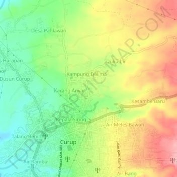
Name: Kesambe Lama topographic map, elevation, terrain.
Location: Kesambe Lama, Rejang Lebong, Bengkulu, Sumatra, Indonesia (-3.47558 102.51468 -3.43558 102.55468)
Average elevation: 671 m
Minimum elevation: 608 m
Maximum elevation: 742 m
Thank you for supporting this site ❤️
Make a donation
Make a donation