
Thank you for supporting this site ❤️
Make a donation
Make a donation
Kota topographic map
Click on the map to display elevation.
Thank you for supporting this site ❤️
Make a donation
Make a donation
About this map
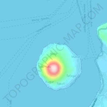
Name: Kota topographic map, elevation, terrain.
Location: Kota, Tidore Kepulauan, North Maluku, Maluku, 97733, Indonesia (0.71761 127.34859 0.75761 127.38859)
Average elevation: 13 m
Minimum elevation: -1 m
Maximum elevation: 344 m
Thank you for supporting this site ❤️
Make a donation
Make a donation