
Thank you for supporting this site ❤️
Make a donation
Make a donation
Le Gros Melon topographic map
Click on the map to display elevation.
Thank you for supporting this site ❤️
Make a donation
Make a donation
About this map
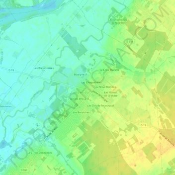
Name: Le Gros Melon topographic map, elevation, terrain.
Average elevation: 90 m
Minimum elevation: 78 m
Maximum elevation: 103 m
Thank you for supporting this site ❤️
Make a donation
Make a donation
Other topographic maps
Click on a map to view its topography, its elevation and its terrain.
Château de Pully
France > Centre-Val de Loire > Loiret > Lailly-en-Val > Le Grand Aunay
Average elevation: 104 m