
Thank you for supporting this site ❤️
Make a donation
Make a donation
Bilar topographic map
Click on the map to display elevation.
Thank you for supporting this site ❤️
Make a donation
Make a donation
About this map
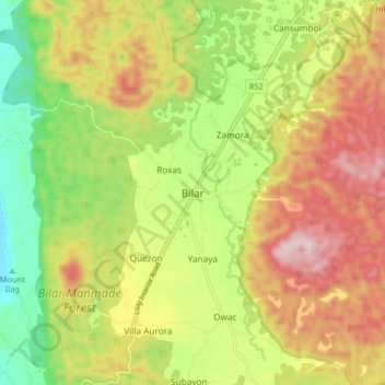
Name: Bilar topographic map, elevation, terrain.
Location: Bilar, Bohol, Central Visayas, Philippines (9.66696 124.06443 9.74696 124.14443)
Average elevation: 317 m
Minimum elevation: 120 m
Maximum elevation: 530 m
Thank you for supporting this site ❤️
Make a donation
Make a donation
Other topographic maps
Click on a map to view its topography, its elevation and its terrain.