
Thank you for supporting this site ❤️
Make a donation
Make a donation
South Lebanon topographic map
Click on the map to display elevation.
Thank you for supporting this site ❤️
Make a donation
Make a donation
About this map
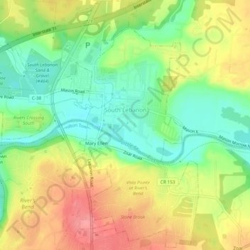
Name: South Lebanon topographic map, elevation, terrain.
Location: South Lebanon, Warren County, Ohio, 45065, United States (39.35102 -84.24604 39.38654 -84.19906)
Average elevation: 219 m
Minimum elevation: 179 m
Maximum elevation: 266 m
Thank you for supporting this site ❤️
Make a donation
Make a donation
Other topographic maps
Click on a map to view its topography, its elevation and its terrain.