
翁达镇 topographic map
Interactive map
Click on the map to display elevation.
About this map
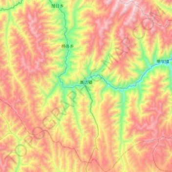
Name: 翁达镇 topographic map, elevation, terrain.
Location: 翁达镇, 色达县, 甘孜藏族自治州, 四川省, 626600, 中国 (31.73810 100.62661 32.00043 100.81966)
Average elevation: 4,052 m
Minimum elevation: 3,186 m
Maximum elevation: 4,911 m
Other topographic maps
Click on a map to view its topography, its elevation and its terrain.