
Thank you for supporting this site ❤️
Make a donation
Make a donation
Pencader topographic map
Click on the map to display elevation.
Thank you for supporting this site ❤️
Make a donation
Make a donation
About this map
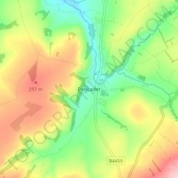
Name: Pencader topographic map, elevation, terrain.
Location: Pencader, Carmarthenshire, Wales, SA39 9HF, United Kingdom (51.98013 -4.28851 52.02013 -4.24851)
Average elevation: 182 m
Minimum elevation: 88 m
Maximum elevation: 300 m
Thank you for supporting this site ❤️
Make a donation
Make a donation
Other topographic maps
Click on a map to view its topography, its elevation and its terrain.